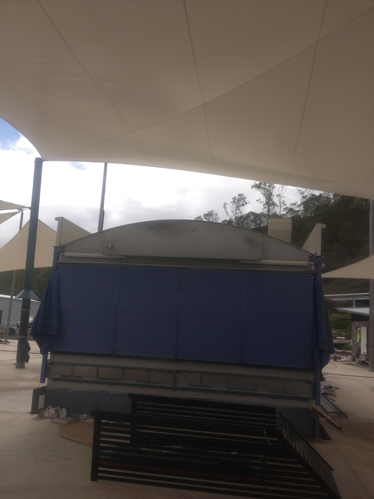
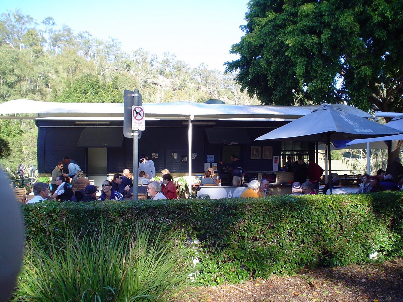
It's now a week since the cafe closed as the remnants of cyclone oswald raged down the coast. The weir is now open - but the bridge at Colleges Crossing is still submerged under metres of water. Wivenhoe dam is still dumping water at the rate of 1660 cubic metres per second - but the river height is starting to fall. As it falls the devastation of the flooding is being revealed.
The dam releases will continue until next Tuesday (5th) at least - and it will take some time after that for the cafe to reopen. We haven't had power at all this week, and Energex will need to reintroduce the power box they removed on Monday.
While most of the park is still submerged, as the river subsides some work is being carried out to try and clean up the damage.
The firies were there this week to help. Pic courtesy QT.
The task of cleaning up the park - which has just been restored after to 2011 flood event - will be immense. Safety warnings have already been posted on the park gates because of the health risks. The alternative route to the park - over the Mt Crosby weir has been closed as debris carried by the raging Brisbane River piled up on the roadway.
With the Mt Crosby weir open it is now possible to visit Colleges Crossing without travelling via Jindalee and the Ipswich Motorway. It's one week down - and hopefully only another week to go.
Friday, February 1, 2013
Sunday, January 27, 2013
River Levels Colleges Crossing
Rain still falling - water still rising.
Colleges Crossing is cut - and has been for two days - and the rate of release from Wivenhoe Dam means that it could take some time before the road is open - and the park is accessible.
The latest info says that the alternate route - across Mt Crosby weir is still open but the water is rising up near 10 metres. That puts it less than 3 metres from the roadway.
Here's the latest graph of the river levels at Mt Crosby. Well over 70,000 megalitres of water have been released into the Brisbane River - and there's no info when these releases will stop.
Colleges Crossing is cut - and has been for two days - and the rate of release from Wivenhoe Dam means that it could take some time before the road is open - and the park is accessible.
The latest info says that the alternate route - across Mt Crosby weir is still open but the water is rising up near 10 metres. That puts it less than 3 metres from the roadway.
Here's the latest graph of the river levels at Mt Crosby. Well over 70,000 megalitres of water have been released into the Brisbane River - and there's no info when these releases will stop.
Deja-vu January
The cafe has been opened just over a week - and already there is a sense of deja-vu. The cafe is closed due to the violent weather - rain and 60 kph winds, plus the release of 500 cubic metres a second from the Wivenhoe Dam.
As usual, Mt Crosby Road is underwater at Colleges Crossing - cutting off access to the Recreation Reserve.
The above pic is courtesy of our good friends at 94.9 Ipswich and their listeners.
This will be a big test for the Colleges Crossing Recreation Reserve which has only recently been rebuilt at a cost of $11m after the disastrous floods of 2011.
The cafe was just getting into the swing of things after two years in mothballs.
Now it has got to survive another hammering by Mother Nature - and so early in its rebirth. Last night the river was over 8 metres at Mt Crosby. There doesn't seem to be a river height monitor anymore at Colleges Crossing.
Yesterday (Saturday), the cafe was getting a solid soaking (pic below). Due to the closed roads - it hasn't been possible to get access today (Sunday) to see how it is surviving the buffeting winds.
If there is one positive out of this extreme weather - it will green up the park which has been suffering badly from the recent 40 degree heat. Remember that line about droughts and flooding rain. We are living it currently at Colleges Crossing.
It's not known just how long the release from the Wivenhoe Dam will continue - but as soon as possible we will be back greeting our many supportive customers.
As usual, Mt Crosby Road is underwater at Colleges Crossing - cutting off access to the Recreation Reserve.
The above pic is courtesy of our good friends at 94.9 Ipswich and their listeners.
This will be a big test for the Colleges Crossing Recreation Reserve which has only recently been rebuilt at a cost of $11m after the disastrous floods of 2011.
The cafe was just getting into the swing of things after two years in mothballs.
Now it has got to survive another hammering by Mother Nature - and so early in its rebirth. Last night the river was over 8 metres at Mt Crosby. There doesn't seem to be a river height monitor anymore at Colleges Crossing.
Yesterday (Saturday), the cafe was getting a solid soaking (pic below). Due to the closed roads - it hasn't been possible to get access today (Sunday) to see how it is surviving the buffeting winds.
If there is one positive out of this extreme weather - it will green up the park which has been suffering badly from the recent 40 degree heat. Remember that line about droughts and flooding rain. We are living it currently at Colleges Crossing.
It's not known just how long the release from the Wivenhoe Dam will continue - but as soon as possible we will be back greeting our many supportive customers.
Sunday, December 23, 2012
Park Open
The Colleges Crossing Recreation Reserve is now open. The reconstruction of the devastated park finished on Friday - and the multi-million dollar rebuilding program has delivered a fun relaxation area on the Brisbane River.
The following photo is courtesy of our friends at the Queensland Times in Ipswich.
| One of the many play areas |
Wednesday, December 12, 2012
Tradesmen's picnic - Colleges Crossing
The multi-million dollar redevelopment of the Colleges Crossing Recreation Reserve is getting closer to be completed. We are now talking in terms of days rather than weeks. It's still very much a tradesmen's picnic area at the moment with a huge amount of work still being carried out around the park. The fashion is hi-vis.
The cafe itself is pretty much a work in progress still. The shade sails are up. There's plenty of plumbing and equipment work being carried out inside. Also a lot of suppliers waiting for the go-ahead to stock the premises up for trading.
The opening date is still in the air - we are hoping that we can put something out for Santa when he comes down the chimney.
Instead of tiles we will have concrete with designs relating to the Brisbane River etched into it. And, the toilet blocks in the background are designed to withstand another major flood - god forbid!
Fingers crossed that the weather will be kind and not delay this huge project. We keen to have the smell of espresso coffee wafting over the park.
The cafe itself is pretty much a work in progress still. The shade sails are up. There's plenty of plumbing and equipment work being carried out inside. Also a lot of suppliers waiting for the go-ahead to stock the premises up for trading.
The opening date is still in the air - we are hoping that we can put something out for Santa when he comes down the chimney.
Instead of tiles we will have concrete with designs relating to the Brisbane River etched into it. And, the toilet blocks in the background are designed to withstand another major flood - god forbid!
Fingers crossed that the weather will be kind and not delay this huge project. We keen to have the smell of espresso coffee wafting over the park.
Wednesday, November 14, 2012
Looking back
With work continuing apace at Colleges Crossing, it's worth looking back at just what the park was like after the disastrous floods of 2011.
This mind blowing photo link allows you to zoom and pan.
http://viewfromabove.com.au/panoramas/2011-01-26%20Colleges%20Crossing/Colleges%20Crossing.html
This mind blowing photo link allows you to zoom and pan.
http://viewfromabove.com.au/panoramas/2011-01-26%20Colleges%20Crossing/Colleges%20Crossing.html
Thursday, November 8, 2012
Ready for Xmas?
Di and Mary visited the resurrected cafe site today. The redecorated cafe is still smack bang in the middle of an extremely busy construction site. It's planned that we should be able to start making coffee about mid-December - but still a lot of work to do.

Thursday, October 18, 2012
It's taken a long time - but the cafe is back!
Tuesday, February 1, 2011
New month - new weather threat
While the future of Colleges by the River still hangs on the outcome of meetings within the Ipswich City Council, the clearing of the park has slowed down from the action of last week.
The extent of the damage was unbelievable - and evident from this aerial shot taken by a photographer from the Courier Mail newspaper.
The question is whether the cafe - still sitting behind a fence on the hill overlooking the park - will be returned in the near future. Colleges Crossing will take a long time to recover.
Meanwhile, the debate continues in the media whether it was a flash storm flood -or a riverine flood. How the insurance companies define what destroyed your house or business will determine whether you get financial support or not. There was an attempt by insurers in 2008 to get a proper definition by it was opposed by consumer legal groups - and knocked by by the ACCC.
The insurance council said this morning (ABC Radio) that about 70 percent of claimants will get paid.
Already insurance companies are playing it by the book - their book, and for businesses like Colleges by the River - our insurance cover will never be what it was.
Meantime - our family in Townsville is sitting in the path of a monster cyclone. The hits just keep on coming. The start of 2011 won't be forgotten for a long time in Queensland.
To get an idea of the immensity of this cyclone - click on the headline to this post - for some spectacular colour animation of what is bearing down on the North Queensland coast.
The extent of the damage was unbelievable - and evident from this aerial shot taken by a photographer from the Courier Mail newspaper.
The question is whether the cafe - still sitting behind a fence on the hill overlooking the park - will be returned in the near future. Colleges Crossing will take a long time to recover.
Meanwhile, the debate continues in the media whether it was a flash storm flood -or a riverine flood. How the insurance companies define what destroyed your house or business will determine whether you get financial support or not. There was an attempt by insurers in 2008 to get a proper definition by it was opposed by consumer legal groups - and knocked by by the ACCC.
The insurance council said this morning (ABC Radio) that about 70 percent of claimants will get paid.
Already insurance companies are playing it by the book - their book, and for businesses like Colleges by the River - our insurance cover will never be what it was.
Meantime - our family in Townsville is sitting in the path of a monster cyclone. The hits just keep on coming. The start of 2011 won't be forgotten for a long time in Queensland.
To get an idea of the immensity of this cyclone - click on the headline to this post - for some spectacular colour animation of what is bearing down on the North Queensland coast.
Monday, January 24, 2011
Ground Zero
Today was the first occasion since 10th January that I was able to walk through the park at Colleges Crossing.
The impact of the devastating flood is awe inspiring - the massive height of the river is evident on the hill overlooking the park and up the few trees that remain. Everything else has been smashed and levelled.
Stunned locals have flocked to the park since the Colleges Crossing bridge opened yesterday. A group from the army were also on hand today to survey the damage - as a Navy helicopter flew overhead. This is not a mop and bucket job - this is a clearance job worthy of our military.
The media were also on hand - from the press and tv - recording the devastation. Even when the cafe was taken to safety on the morning of the 10th - the river while rising through the park didn't seem to have much power behind it. What happened since then was that a relentless torrent of water has ripped and stripped the parkland. The height that the river reached is hard to imagine until you stand in the middle of the park and see metal wrapped around posts - posts bolted in concrete ripped out and twisted, wood and metal toilet blocks just washed away.
We've survived floods at the cafe - the latest 10m efforts in October and December, and after the water subsided - it was back to work, brewing the coffee.
This time, the cafe will be sitting on the side of the road on the top of the hill for sometime.
We've donated ice creams which were put into storage, to the Australia Day celebrations in Ipswich. We'll now have to wait for our own reopening celebrations - watch this space.
The impact of the devastating flood is awe inspiring - the massive height of the river is evident on the hill overlooking the park and up the few trees that remain. Everything else has been smashed and levelled.
Stunned locals have flocked to the park since the Colleges Crossing bridge opened yesterday. A group from the army were also on hand today to survey the damage - as a Navy helicopter flew overhead. This is not a mop and bucket job - this is a clearance job worthy of our military.
The media were also on hand - from the press and tv - recording the devastation. Even when the cafe was taken to safety on the morning of the 10th - the river while rising through the park didn't seem to have much power behind it. What happened since then was that a relentless torrent of water has ripped and stripped the parkland. The height that the river reached is hard to imagine until you stand in the middle of the park and see metal wrapped around posts - posts bolted in concrete ripped out and twisted, wood and metal toilet blocks just washed away.
We've survived floods at the cafe - the latest 10m efforts in October and December, and after the water subsided - it was back to work, brewing the coffee.
This time, the cafe will be sitting on the side of the road on the top of the hill for sometime.
We've donated ice creams which were put into storage, to the Australia Day celebrations in Ipswich. We'll now have to wait for our own reopening celebrations - watch this space.
Saturday, January 22, 2011
Memories
Click on the title and you'll see what Colleges Crossing looked like in the early morning of the 5th June 2010.
Its in sharp contrast to what has happened to our park in the last couple of weeks.
It will take a massive effort on behalf of the Ipswich City Council to rebuild and replant the park to anything like it was.
The flood damage has levelled just about every tree and washed away the landscape and gardens.
The cafe was removed - as it was designed for - on the 10th January, just in time as the flood front made its way downstream.
This is the slot that the cafe rested in before and after:
The bridge at Colleges Crossing was a hive of activity today - as the clean up of the roads got underway. But, the river is still flowing over the bridge preventing engineers carrying out their inspections.
The road is not only a link to the Colleges Crossing Recreation Reserve, but is also an important connection for people accessing schools in the Ipswich area. With the weir bridge to be repaired - it will be the only link. Most of the school buses are on the Ipswich side of the river - and a round trip via the Centenary Motorway is 100 kilometres. School starts next week.
After taking a nostalgic look at the June pictures - it will be interesting to see how long it will take to repair and the park - and what it will look like. Fingers crossed.
Its in sharp contrast to what has happened to our park in the last couple of weeks.
It will take a massive effort on behalf of the Ipswich City Council to rebuild and replant the park to anything like it was.
The flood damage has levelled just about every tree and washed away the landscape and gardens.
The cafe was removed - as it was designed for - on the 10th January, just in time as the flood front made its way downstream.
This is the slot that the cafe rested in before and after:
The bridge at Colleges Crossing was a hive of activity today - as the clean up of the roads got underway. But, the river is still flowing over the bridge preventing engineers carrying out their inspections.
The road is not only a link to the Colleges Crossing Recreation Reserve, but is also an important connection for people accessing schools in the Ipswich area. With the weir bridge to be repaired - it will be the only link. Most of the school buses are on the Ipswich side of the river - and a round trip via the Centenary Motorway is 100 kilometres. School starts next week.
After taking a nostalgic look at the June pictures - it will be interesting to see how long it will take to repair and the park - and what it will look like. Fingers crossed.
Thursday, January 20, 2011
We'll be back!
Channel 9 News finally gave us all a close up look at the destruction of our beautiful park - and, for those who have spent any time at Colleges Crossing - it was gut wrenching.
The park has been a magnet for people of the south-east for a century. Now its a pile of rubble.
But, the council has pledged to rebuild - and the job is enormous. Have a look at the Nine news story by Darren Curtis: http://video.au.msn.com/watch/video/colleges-crossing-a-disaster-zone/xr3nld5
or click on the headline.
Its hard to picture what it will look like after the bulldozers start the reshaping of the park.
Getting there is also going to be a challenge - I checked out the alternate route over the Mt Crosby weir road - and its already a construction zone.
The Mt Crosby Road bridge over Colleges Crossing has been submerged since the 8th Jan and punished by the raging Brisbane River flood. Look what that water did to the park - what has it done to the structural integrity of the bridge.
When can we start selling coffee? I think its going to be some time before we can realistically consider it.
But this area is resilient - and changed a bit over the years - here's a picture taken in 1915.
As the promised reconstruction gets underway its doubtful that it will look exactly like it used to - here's some memories:
Whatever happens - it will still be Colleges
- a unique riverside park. And, we'll be there at its rebirth.
The park has been a magnet for people of the south-east for a century. Now its a pile of rubble.
But, the council has pledged to rebuild - and the job is enormous. Have a look at the Nine news story by Darren Curtis: http://video.au.msn.com/watch/video/colleges-crossing-a-disaster-zone/xr3nld5
or click on the headline.
Its hard to picture what it will look like after the bulldozers start the reshaping of the park.
Getting there is also going to be a challenge - I checked out the alternate route over the Mt Crosby weir road - and its already a construction zone.
The Mt Crosby Road bridge over Colleges Crossing has been submerged since the 8th Jan and punished by the raging Brisbane River flood. Look what that water did to the park - what has it done to the structural integrity of the bridge.
When can we start selling coffee? I think its going to be some time before we can realistically consider it.
But this area is resilient - and changed a bit over the years - here's a picture taken in 1915.
As the promised reconstruction gets underway its doubtful that it will look exactly like it used to - here's some memories:
Whatever happens - it will still be Colleges
- a unique riverside park. And, we'll be there at its rebirth.
Wednesday, January 19, 2011
Park Devastated
The water has dropped in the Brisbane River at Colleges Crossing with the gates closed at Wivenhoe.
The river height monitor at the Mt Crosby weir is not registering at the moment - but one would expect that the roadway would be exposed.
Word is that there is a lot of damage on the approaches to the bridge. At Colleges Crossing this afternoon the bridge was still under water, and the roads are covered in debris and silt.
From the Karana Downs side of the river the damage to the park on the opposite bank is obvious. This has been enormous destruction. Aerial shots from nearmap.com taken last Friday showed that the tree that was a major feature of the cafe had been uprooted. Today the scene in the park was akin to the aftermath of a cyclone.
What appears to be the bird hide has been dumped into the middle of the river.
As the river keeps falling, and when Mt Crosby Road is open it will be possible to have a close-up inspection of the disaster. It doesn't look pretty, and won't be fixed quickly. So many trees have been destroyed, and it appears that a lot of the park has been reshaped by the raging torrent over the past two weeks.
This afternoon, a wild storm raged through the area, something that is becoming a bit repetitive of late.
There's also a warning of a flood (king) tide expected on Friday in Brisbane. The river is still tidal at Colleges Crossing, and it will be interesting to see if that big tide on Friday will have much impact.
The river height monitor at the Mt Crosby weir is not registering at the moment - but one would expect that the roadway would be exposed.
Word is that there is a lot of damage on the approaches to the bridge. At Colleges Crossing this afternoon the bridge was still under water, and the roads are covered in debris and silt.
From the Karana Downs side of the river the damage to the park on the opposite bank is obvious. This has been enormous destruction. Aerial shots from nearmap.com taken last Friday showed that the tree that was a major feature of the cafe had been uprooted. Today the scene in the park was akin to the aftermath of a cyclone.
What appears to be the bird hide has been dumped into the middle of the river.
As the river keeps falling, and when Mt Crosby Road is open it will be possible to have a close-up inspection of the disaster. It doesn't look pretty, and won't be fixed quickly. So many trees have been destroyed, and it appears that a lot of the park has been reshaped by the raging torrent over the past two weeks.
This afternoon, a wild storm raged through the area, something that is becoming a bit repetitive of late.
There's also a warning of a flood (king) tide expected on Friday in Brisbane. The river is still tidal at Colleges Crossing, and it will be interesting to see if that big tide on Friday will have much impact.
Tuesday, January 18, 2011
High & Dry
The cafe and the two halves of the caretaker's residence are sitting on the hill overlooking the still flooded Colleges Crossing.
Click on the heading to have a look at the pic from nearmap.com will did a flyover during the Brisbane flood crisis.
The flood water is still surging through the park with the Brisbane River Mt Crosby hovering around 15.85m
From memory, I think around we should see the road across the weir appear around 11m. As we now enter the second week of the flood disaster in this area, it will take a few days before we can see what damage has been done.
About 10,000 cars a day use Mt Crosby Road over the Colleges Crossing bridge, so to have all road access to Ipswich cut is a major disruption to a lot of people.
People can't believe that while the river is so benign in Brisbane at the moment that we are still suffering from flood waters.
Click on the heading to have a look at the pic from nearmap.com will did a flyover during the Brisbane flood crisis.
The flood water is still surging through the park with the Brisbane River Mt Crosby hovering around 15.85m
From memory, I think around we should see the road across the weir appear around 11m. As we now enter the second week of the flood disaster in this area, it will take a few days before we can see what damage has been done.
About 10,000 cars a day use Mt Crosby Road over the Colleges Crossing bridge, so to have all road access to Ipswich cut is a major disruption to a lot of people.
People can't believe that while the river is so benign in Brisbane at the moment that we are still suffering from flood waters.
Monday, January 17, 2011
The river is wide
Checked out the river at Karana Downs where Mt Crosby Road winds over the bridge at Colleges Crossing. While the flood threat passed last week for most of Brisbane, here at Colleges Crossing it hasn't dropped much.
Wivenhoe dam is at 123% and dropping, discharging around 299,000 megalitres a day. The gates closing sequence is underway and at this stage the gates are expected to be closed by mid week.
The river is still hundreds of metres wide at the crossing, and we'll have to wait until the water subsides to get any idea how much devastation there is in the park.
The Mt Crosby weir is at 16.2m and rising at the moment, despite the gate shutdown sequence at the dam.
What can be seen from the opposite bank is the frame of the shade sails that were a feature of the cafe. From a distance it's hard to make out how our iconic tree survived. It seems like there's a huge pile of debris in the area.
What I think was the bird hide is just some sticks and very little else.
Some official estimates put the time frame of the water dropping enough to access the park as the middle of next week.
In the meantime, it just a waiting game.
Wivenhoe dam is at 123% and dropping, discharging around 299,000 megalitres a day. The gates closing sequence is underway and at this stage the gates are expected to be closed by mid week.
The river is still hundreds of metres wide at the crossing, and we'll have to wait until the water subsides to get any idea how much devastation there is in the park.
The Mt Crosby weir is at 16.2m and rising at the moment, despite the gate shutdown sequence at the dam.
What can be seen from the opposite bank is the frame of the shade sails that were a feature of the cafe. From a distance it's hard to make out how our iconic tree survived. It seems like there's a huge pile of debris in the area.
What I think was the bird hide is just some sticks and very little else.
Some official estimates put the time frame of the water dropping enough to access the park as the middle of next week.
In the meantime, it just a waiting game.
Sunday, January 16, 2011
When 100 percent is half-full
Many people, including me have struggled with the percentages used by authorities to explain the amount of water held by Wivenhoe dam.
For example, during the Brisbane flood event it was said that the dam was 186% full. Now there's a head-scratching number. How can a dam be more than 100% full?
It appears that the full capacity of the dam is 225% - with 100% referring to the storage of the region's drinking water and anything above that is for flood storage.
Still don't understand? Check out an article published yesterday by the Australian Geographic. Simply click on this article's headline.
One thing the article doesn't touch on is the legislation that requires seqwater to drain the floodwaters stored - 'within the required 7 days'.
Now what's that all about?
The economic cost of the Queensland floods is expected to be the highest in Australia's history. The federal government has already paid out $52m in immediate support to victims. The Premier's flood appeal has raised $85 million, and Ms Bligh has promised all the money will go directly to victims.
The river level at Colleges Crossing is still at catastrophic heights, and it should be remembered that the level at Mt Crosby at the peak of the flood was 26m. Colleges Crossing has been hit by a series of floods over the last couple of months as a result of those dam releases of stored floodwaters to comply with the 'required 7 days' in the legislation.
As everyone is aware the cafe at Colleges Crossing was removed last Monday as the flood levels got to critical levels.
Well since then I've be able to dig up a copy of the Local Bulletin news magazine from 1996 which featured the May floods of that year during which the cafe was also moved to the top of the hill overlooking the park.
The estimated cost for the repairs nearly 15 years ago was $150,000. The figure this year will leave that in the shade.
These latest releases from Wivenhoe dam are continuing around 300,000 megalitres a day, and Colleges Crossing is expected to remain inundated until the middle of next week.
It won't be a pretty sight when the water finally subsides.
It may been long time before the cafe reopens.
For example, during the Brisbane flood event it was said that the dam was 186% full. Now there's a head-scratching number. How can a dam be more than 100% full?
It appears that the full capacity of the dam is 225% - with 100% referring to the storage of the region's drinking water and anything above that is for flood storage.
Still don't understand? Check out an article published yesterday by the Australian Geographic. Simply click on this article's headline.
One thing the article doesn't touch on is the legislation that requires seqwater to drain the floodwaters stored - 'within the required 7 days'.
Now what's that all about?
The economic cost of the Queensland floods is expected to be the highest in Australia's history. The federal government has already paid out $52m in immediate support to victims. The Premier's flood appeal has raised $85 million, and Ms Bligh has promised all the money will go directly to victims.
The river level at Colleges Crossing is still at catastrophic heights, and it should be remembered that the level at Mt Crosby at the peak of the flood was 26m. Colleges Crossing has been hit by a series of floods over the last couple of months as a result of those dam releases of stored floodwaters to comply with the 'required 7 days' in the legislation.
As everyone is aware the cafe at Colleges Crossing was removed last Monday as the flood levels got to critical levels.
Well since then I've be able to dig up a copy of the Local Bulletin news magazine from 1996 which featured the May floods of that year during which the cafe was also moved to the top of the hill overlooking the park.
The estimated cost for the repairs nearly 15 years ago was $150,000. The figure this year will leave that in the shade.
These latest releases from Wivenhoe dam are continuing around 300,000 megalitres a day, and Colleges Crossing is expected to remain inundated until the middle of next week.
It won't be a pretty sight when the water finally subsides.
It may been long time before the cafe reopens.
Nothing Changing
The river level at the Mt Crosby Weir is still at 16.5m - a level that has been constant since Friday.
Authorities are still releasing water from the Wivenhoe Dam - which is around 150 percent of capacity.
At the start of the weekend it was dumping water into the Brisbane River at about 300,000 megalitres a day.
It's expected that the Mt Crosby Weir bridge will be under water until the middle of next week.
Life is getting back to normal - washing clothes, unpacking evacuation essentials (still) and slowly stocking up on food.
There was an enormous generousity of spirit among Brisbane residents yesterday, and today as the massive clean-up continues.
Authorities are still releasing water from the Wivenhoe Dam - which is around 150 percent of capacity.
At the start of the weekend it was dumping water into the Brisbane River at about 300,000 megalitres a day.
It's expected that the Mt Crosby Weir bridge will be under water until the middle of next week.
Life is getting back to normal - washing clothes, unpacking evacuation essentials (still) and slowly stocking up on food.
There was an enormous generousity of spirit among Brisbane residents yesterday, and today as the massive clean-up continues.
Saturday, January 15, 2011
Survivor - Karana Downs
With power restored last night (8pm) - life returned to normal after a week in which we had been cut off from the outside world. No electricity, no phone, no food, no petrol, and cars packed to the roof ready for evacuation. The Mt Crosby weir was drowned under 26 metres of flood waters - Colleges Crossing continued to the cut - and the only road east to Brisbane was also under water.
The authorities finally realised that there were people living in the exotic far-flung suburbs of Karana Downs, Mt Crosby and Bellbowrie, late Thursday afternoon - despite the fact that these areas were the first to be inundated by the huge flood. By the way - there's about 25,000 people living in this area. A lot to lose in disaster planning.
The Brisbane River level at Mt Crosby today is still running at near 17 metres.
The river at Colleges Crossing is still raging on a wide front. The Navy is running emergency boats across the water from Karana Downs to the Chuwar side.
The above picture is taken from the Karana Downs side of the road leading to the bridge across Colleges Crossing. Remember what it looked like - it has been underwater for the best part of three months.
The devastation of Colleges Crossing looks complete. There were reports that the iconic fig tree at the cafe had been uprooted. Observing the scene from the Karana Downs side yesterday there was nothing to see but a sea of water. What could be seen was the awnings that surrounded the cafe laying crumpled up against the road up the hill. The peak flood level reached halfway up the hill.
If the tree and awnings have been swept away, it is fair to assume that the entire deck that the cafe was on has been devastated.
The above photo is of what used to be the Colleges Crossing park.
Seqwater yesterday increased the releases from Wivenhoe dam to 301,000 megalitres - so the flooding through the area will continue for sometime. It will take a while the the waters to subside - so that the full extent of the damage to the park can be assessed.
But, it would be fair to say that the cafe will be closed for a long time.
Today, it starting raining, and the cycle starts over again - there are cyclones dawdling around off the coast.
The authorities finally realised that there were people living in the exotic far-flung suburbs of Karana Downs, Mt Crosby and Bellbowrie, late Thursday afternoon - despite the fact that these areas were the first to be inundated by the huge flood. By the way - there's about 25,000 people living in this area. A lot to lose in disaster planning.
The Brisbane River level at Mt Crosby today is still running at near 17 metres.
The river at Colleges Crossing is still raging on a wide front. The Navy is running emergency boats across the water from Karana Downs to the Chuwar side.
The above picture is taken from the Karana Downs side of the road leading to the bridge across Colleges Crossing. Remember what it looked like - it has been underwater for the best part of three months.
The devastation of Colleges Crossing looks complete. There were reports that the iconic fig tree at the cafe had been uprooted. Observing the scene from the Karana Downs side yesterday there was nothing to see but a sea of water. What could be seen was the awnings that surrounded the cafe laying crumpled up against the road up the hill. The peak flood level reached halfway up the hill.
If the tree and awnings have been swept away, it is fair to assume that the entire deck that the cafe was on has been devastated.
The above photo is of what used to be the Colleges Crossing park.
Seqwater yesterday increased the releases from Wivenhoe dam to 301,000 megalitres - so the flooding through the area will continue for sometime. It will take a while the the waters to subside - so that the full extent of the damage to the park can be assessed.
But, it would be fair to say that the cafe will be closed for a long time.
Today, it starting raining, and the cycle starts over again - there are cyclones dawdling around off the coast.
Tuesday, January 11, 2011
Wivenhoe to reduce flows
Seqwater a short time ago announced that it was going to reduce releases from the Wivenhoe - as a huge flood front moves towards Brisbane.
The Flood Operations Centre will reduce releases slowly tonight. The first reduction will be to 610,000 megalitres per day.
The recent 10m river levels at Colleges Crossing were the result of releases of 130,000 megalitres.
The current Brisbane River levels at the Mt Crosby weir is 22.94m - and at Colleges Crossing, where the cafe once proudly stood, is at 15.81m.
If you live in the western suburbs and want to look at the flood modelling for your area or street - click on the heading.
Where the 25ha Colleges Crossing park was, is now submerged under a raging Brisbane River.
Some residents at Karalee have already evacuated. The Bremer River which runs into the Brisbane at Karalee is expected to flood Ipswich at record levels.
The persistent heavy rain of today has moderated tonight - and it will be interesting how tomorrow turns out.
The flood crisis has caused a lot of anxiety in the Brisbane area - especially with predictions that river levels will exceed the disastrous 1974 flood.
The Flood Operations Centre will reduce releases slowly tonight. The first reduction will be to 610,000 megalitres per day.
The recent 10m river levels at Colleges Crossing were the result of releases of 130,000 megalitres.
The current Brisbane River levels at the Mt Crosby weir is 22.94m - and at Colleges Crossing, where the cafe once proudly stood, is at 15.81m.
If you live in the western suburbs and want to look at the flood modelling for your area or street - click on the heading.
Where the 25ha Colleges Crossing park was, is now submerged under a raging Brisbane River.
Some residents at Karalee have already evacuated. The Bremer River which runs into the Brisbane at Karalee is expected to flood Ipswich at record levels.
The persistent heavy rain of today has moderated tonight - and it will be interesting how tomorrow turns out.
The flood crisis has caused a lot of anxiety in the Brisbane area - especially with predictions that river levels will exceed the disastrous 1974 flood.
Lucky Cafe
With the devastation that is hitting Toowoomba and the Lockyer area - we are extremely lucky that we were able to move our cafe before the wall of water hit Colleges Crossing.
Trucking the cafe up to the top of the hill at Allawah Road means that we were able to save the cafe. The water through Colleges Crossing park, has now reached 15m. For those who know the cafe, the water level is above the hedge that surrounded the cafe.
Here's an old photo to give you an idea of the height.
There's more to come, with the flood front from Lockyer creek to join up with the rising Brisbane River. The whole of the 25ha park is underwater.
We count ourselves lucky that the cafe was designed to be moved - avoiding massive damage to the building and its contents.
The massive amount of water going over the Mt Crosby weir is an awesome sight.
It of course means that there is no access to Ipswich from the west of Brisbane.
Up Toowoomba way the damage and devastation is unprecedented and our hearts go out to them - its been compared to Cyclone Tracey that wiped out Darwin in 1975.
Trucking the cafe up to the top of the hill at Allawah Road means that we were able to save the cafe. The water through Colleges Crossing park, has now reached 15m. For those who know the cafe, the water level is above the hedge that surrounded the cafe.
Here's an old photo to give you an idea of the height.
There's more to come, with the flood front from Lockyer creek to join up with the rising Brisbane River. The whole of the 25ha park is underwater.
We count ourselves lucky that the cafe was designed to be moved - avoiding massive damage to the building and its contents.
The massive amount of water going over the Mt Crosby weir is an awesome sight.
It of course means that there is no access to Ipswich from the west of Brisbane.
Up Toowoomba way the damage and devastation is unprecedented and our hearts go out to them - its been compared to Cyclone Tracey that wiped out Darwin in 1975.
Subscribe to:
Posts (Atom)