Saturday, January 15, 2011

Survivor - Karana Downs

With power restored last night (8pm) - life returned to normal after a week in which we had been cut off from the outside world. No electricity, no phone, no food, no petrol, and cars packed to the roof ready for evacuation. The Mt Crosby weir was drowned under 26 metres of flood waters - Colleges Crossing continued to the cut - and the only road east to Brisbane was also under water.
The authorities finally realised that there were people living in the exotic far-flung suburbs of Karana Downs, Mt Crosby and Bellbowrie, late Thursday afternoon - despite the fact that these areas were the first to be inundated by the huge flood. By the way - there's about 25,000 people living in this area. A lot to lose in disaster planning.

The Brisbane River level at Mt Crosby today is still running at near 17 metres.
The river at Colleges Crossing is still raging on a wide front. The Navy is running emergency boats across the water from Karana Downs to the Chuwar side.


The above picture is taken from the Karana Downs side of the road leading to the bridge across Colleges Crossing. Remember what it looked like - it has been underwater for the best part of three months.

The devastation of Colleges Crossing looks complete. There were reports that the iconic fig tree at the cafe had been uprooted. Observing the scene from the Karana Downs side yesterday there was nothing to see but a sea of water. What could be seen was the awnings that surrounded the cafe laying crumpled up against the road up the hill. The peak flood level reached halfway up the hill.
If the tree and awnings have been swept away, it is fair to assume that the entire deck that the cafe was on has been devastated.


The above photo is of what used to be the Colleges Crossing park.

Seqwater yesterday increased the releases from Wivenhoe dam to 301,000 megalitres - so the flooding through the area will continue for sometime. It will take a while the the waters to subside - so that the full extent of the damage to the park can be assessed.
But, it would be fair to say that the cafe will be closed for a long time.
Today, it starting raining, and the cycle starts over again - there are cyclones dawdling around off the coast.

Tuesday, January 11, 2011

Wivenhoe to reduce flows

Seqwater a short time ago announced that it was going to reduce releases from the Wivenhoe - as a huge flood front moves towards Brisbane.
The Flood Operations Centre will reduce releases slowly tonight. The first reduction will be to 610,000 megalitres per day.
The recent 10m river levels at Colleges Crossing were the result of releases of 130,000 megalitres.
The current Brisbane River levels at the Mt Crosby weir is 22.94m - and at Colleges Crossing, where the cafe once proudly stood, is at 15.81m.
If you live in the western suburbs and want to look at the flood modelling for your area or street - click on the heading.
Where the 25ha Colleges Crossing park was, is now submerged under a raging Brisbane River.


Some residents at Karalee have already evacuated. The Bremer River which runs into the Brisbane at Karalee is expected to flood Ipswich at record levels.
The persistent heavy rain of today has moderated tonight - and it will be interesting how tomorrow turns out.
The flood crisis has caused a lot of anxiety in the Brisbane area - especially with predictions that river levels will exceed the disastrous 1974 flood.

Lucky Cafe

With the devastation that is hitting Toowoomba and the Lockyer area - we are extremely lucky that we were able to move our cafe before the wall of water hit Colleges Crossing.


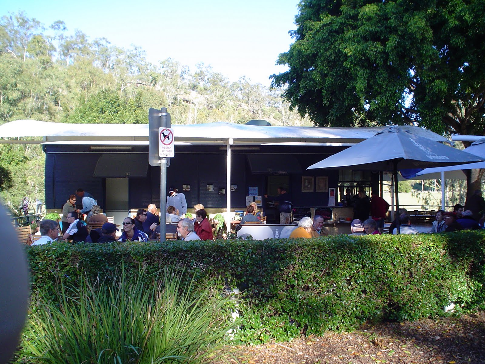
Trucking the cafe up to the top of the hill at Allawah Road means that we were able to save the cafe. The water through Colleges Crossing park, has now reached 15m. For those who know the cafe, the water level is above the hedge that surrounded the cafe.
Here's an old photo to give you an idea of the height.


There's more to come, with the flood front from Lockyer creek to join up with the rising Brisbane River. The whole of the 25ha park is underwater.

We count ourselves lucky that the cafe was designed to be moved - avoiding massive damage to the building and its contents.

The massive amount of water going over the Mt Crosby weir is an awesome sight.
It of course means that there is no access to Ipswich from the west of Brisbane.
Up Toowoomba way the damage and devastation is unprecedented and our hearts go out to them - its been compared to Cyclone Tracey that wiped out Darwin in 1975.

Monday, January 10, 2011

This is real coffee To-Go

Talk about take-away coffee- our cafe Colleges by the River was today lifted onto a low-loader and taken to higher ground.


Its expected that the Brisbane River height will hit 14m at the Colleges Crossing Park - and there's a spectacular amount of water washing through the area at the moment. Its currently 11.66m in the park - and the Wivenhoe dam is due to dump a huge amount of water on top of that. The water is lapping at the wall of the cafe deck.

Click this link to track the river height:
http://www.bom.gov.au/fwo/IDQ65389/IDQ65389.540063.plt.shtml
Or click the heading.

Mt Crosby Road is well underwater at the Colleges Crossing bridge - and the only other route to Ipswich - the Mt Crosby weir is at 13.97m. The only way to get to Ipswich from the western suburbs is via the Centenary Highway - a trip of about 50kms.

And, things are only going to get worse for those who live in this beautiful area - one of the roads to Bellbowrie is under.

The cafe, and the caretaker's cottage are now sitting on the side of the road at Allawah Road.

All that is left in the park is only memories.

Packed and Ready to Go

Called in by the local authorities and SES late last night to prepare the cafe for a new flood peak.
Word is that the flood waters from Lockyer Creeek - near Gatton will combine with increased releases from Wivenhoe dam - and hit around 13m at Colleges Crossing.
Water is not far from the cafe wall with the river level tonight at 10.21m.
The SES joined staff in packing and preparing the cafe for evacuation.


We were also advised that the only alternate route to the Colleges Crossing bridge - the Mt Crosby weir is closed. The river level at the weir is 12.69m.
That means for anyone living in this area - a 50km round trip.
Which local politician said recently that no money should be spent on Colleges Crossing? Good luck with your future career.
If the flood levels do reach the heights predicted - the cafe and the caretakers house will be shifted to higher ground.
It is one of the unique features of the Colleges by the River cafe that it was designed for just such an emergency.
Tomorrow (Monday) a decision will be made whether to shift the cafe to higher ground on the back of a flatbed truck.
But, preparing for that meant that staff and SES people worked until the early hours packing everything up.
The caretakers residence was also prepared for evacuation - it may also be transported out of the park.
Work teams will be back on site early in the morning to access the situation.
Thanks to everyone who helped with the work at the cafe throughout the night.

Sunday, January 9, 2011

Closing Down

The flood level in the Brisbane River at Colleges Crossing is reaching record highs. For the first time in memory - the water level is threatening the emergency entrance to the park. The official river level has broken 9m - and high tide is due at 4pm.
Its a massive amount of water raging through the area, and locals will have to use the one-lane bridge over the weir at Mt Crosby for some time yet.
The rain has been relentless, and flooding in the catchment and streams can only add to the flood levels in the area.
The estimated damage bill to Colleges Crossing Recreation Reserve during the most recent flood was $45k.
Because of the threat of rising water and the possibility of the water rising higher we have reluctantly closed down the cafe's operations so that we can evacuate through the only exit left. We will access our situation again tomorrow morning.
We've living up to our slogan - There's no place like it, and, in Brisbane and Ipswich at the moment that's true.
We will post some photos this afternoon.

Relaxing Sunday

Colleges by the River is open - serving breakfast and espresso coffee.
The park is part of the river bed at the moment - with flood heights matching the October levels.
While its low tide at the moment - the river height is a fraction under 9 metres.
The Mt Crosby weir is 11.21m and rising. The weather is overcast - but quite calm - so far.
We appreciate the support of those people who are making the effort to visit the park and cafe.
There's no place in the south-east where you can watch the floods close up while enjoying your bacon and eggs.